
Oakland ZIP Code Coverage by Area
Oakland's official ZIP figure shows fifteen main mapped ZIP areas, but the lines are postal and planning geography rather than a resident roll. Neighborhood names help orient a search, while the city line, parcel situs, and post-office context answer different questions. The Oakland ZIP code directory is most useful when each row is read as a starting area, not as proof that every parcel or household shares one municipal identity.
| ZIP Code | Areas Covered | Post Office | Notes |
|---|---|---|---|
| 94601 | Fruitvale, Lower Dimond, Jingletown vicinity | Fruitvale-area postal delivery | Primarily Oakland; edges near Alameda estuary |
| 94602 | Glenview, Dimond, Oakmore, Lincoln Highlands | Dimond-area delivery | Wraps hills and central-east areas; neighborhood lines are not ZIP lines |
| 94603 | Elmhurst, Sobrante Park, far East Oakland | East Oakland delivery | Near San Leandro boundary |
| 94605 | Eastmont, Millsmont, Sequoyah, east hills | East Oakland and hills delivery | Large ZIP from flatlands to city edge |
| 94606 | Eastlake, Clinton, Highland Park, Lake Merritt southeast | Eastlake-area delivery | Close to 94610 and 94601 boundaries |
| 94607 | Downtown west, Jack London, Chinatown, West Oakland, Port | Downtown and West Oakland stations | Includes port, industrial, and residential areas |
| 94608 | North and West Oakland and Emeryville mailing geography | Emeryville-associated postal geography | Major ZIP and city mismatch |
| 94609 | Temescal, Longfellow, Mosswood, parts of North Oakland | Temescal and North Oakland delivery | Near Berkeley boundary |
| 94610 | Grand Lake, Lakeshore, Adams Point, Cleveland Heights | Grand Lake and Lake Merritt delivery | Borders Piedmont and 94611 and 94606 |
| 94611 | Piedmont Avenue, Montclair, north hills, and Piedmont postal use | Montclair and Piedmont-area delivery | Crosses the Oakland and Piedmont municipal distinction |
| 94612 | Downtown, Uptown, City Center | Downtown station | Dense business and government addresses |
| 94613 | Mills College at Northeastern University campus | Unique and institutional ZIP context | Not an ordinary neighborhood resident roll |
| 94618 | Rockridge, Upper Rockridge, Claremont | Rockridge delivery | Touches Berkeley and Contra Costa hills context |
| 94619 | Redwood Heights, Laurel, Maxwell Park, Leona Heights | Laurel and east-central delivery | Broad terrain and neighborhood mix |
| 94621 | Coliseum, Airport and Edgewater, Brookfield, East Oakland | Airport and Coliseum delivery | Includes industrial, airport, and residential tracts |
94608 is strongly tied to Emeryville mailing geography. 94611 crosses the intuitive Oakland and Piedmont line. 94613 is tied to a campus, while 94607 and 94621 include port, airport, or industrial land. A ZIP guide should flag those facts before a reader compares counts or assumes that every row represents ordinary households.
Nearby 94705 appears at the Berkeley and Claremont edge, but it should not be treated as a regular Oakland ZIP merely because the generalized map looks close. The research did not expose an authoritative current list of every Oakland PO-box or unique code, including possible 94604 use, so a specific address needs a USPS check before a definitive claim.
Oakland ZIP Boundaries Cross More Than One City
ZIP routing and city jurisdiction answer different questions. The official Oakland ZIP figure places the city beside Berkeley, Piedmont, San Leandro, Alameda, and unincorporated edges. A mailing line may use Oakland or an associated postal city even when a parcel lies in another municipality. The right agency follows the record being sought: Oakland or Alameda planning geography for jurisdiction, the Assessor for a parcel, the recorder for an instrument, and the postal system for delivery.
Mismatch check. A 94608 or 94611 address needs a city and parcel check before an Oakland record search. Postal geography is a clue, not a jurisdictional conclusion.
The same caution applies to a city address carrying a neighboring postal label. The city line can control permits, civic contacts, and public requests even when the ZIP code points a reader toward another station. The map is a useful visual screen, but a specific delivery address needs a postal check and a specific parcel needs an official situs check.
Finding Oakland Residents by ZIP Code
A ZIP code directory can narrow a place, but only some Oakland systems can use ZIP as a search key. The parcel viewer is built around address and APN. Oakland GIS can display a Zipcodes layer. The public voter tools authenticate one voter, while an approved voter file can be filtered after delivery. A permit module may accept address, ZIP, or contact fields, but no complete ZIP-wide person export is promised.
- Confirm the exact delivery ZIP and city label for the address being studied.
- Use the Oakland GIS Zipcodes layer to orient the area, then open the Assessor Parcel Viewer with an address or APN.
- If voter information is needed, use a self-lookup for the voter or follow the restricted file process for a qualifying purpose.
- Check the parcel, permit, or historical source that can answer the actual question instead of treating the ZIP as a resident list.
- When a ZIP narrows to a street, continue with the Oakland street directory for address-keyed records.
The handoff matters. A map can show where the ZIP sits. A parcel can show an APN and situs. A deed can show a named party to an instrument. None of those steps alone identifies every person at an address.
Which Oakland Portals Can Filter ZIP
Portal limits are part of ZIP research. The following field and layer inventory separates a map display from a name search, an authenticated record from an approved file, and aggregate counts from individual records.
| Field or layer | Search key | What it can show | Limit |
|---|---|---|---|
| Oakland GIS Zipcodes layer | Map layer | ZIP geography and related planning layers | Map display, not a resident list |
| Assessor Parcel Viewer | Address or APN | Parcel geometry, situs, map references, and public assessment fields | No published general ZIP-wide owner-name search |
| Oakland permit search | Address fields; ZIP or contact fields may appear by module | Post-1987 building, code, and planning records | No promise of a complete ZIP export |
| Public voter status tools | First name, last name, DOB, and identity fields | One authenticated registration profile | Cannot browse a ZIP's voters |
| Approved voter file | ZIP after delivery | Authorized registration records and optional history or district files | Purpose, security, fee, and certification limits |
| Alameda eData | Aggregate filters and maps | Registration counts and breakdowns | No personal names |
Cal-ViDa can tabulate aggregate birth and death counts by ZIP, but it does not turn those counts into names. The Assessor's map remains the practical address-to-parcel bridge. A name search belongs with a custodian whose index is designed for names, not with a map layer that only colors a boundary.
94608 Tells a Mailing and City Mismatch
94608 carries the clearest Oakland ZIP geography warning. Its broad coverage includes North and West Oakland plus Emeryville mailing geography. A reader who sees an Oakland-related ZIP may assume a city record follows, but the postal label does not prove the parcel sits inside Oakland. Confirm the city, county, and parcel before choosing a permit desk, public-record route, or local civic contact.
The mismatch is not a flaw in the mail system. ZIP areas are built for delivery, while city lines and parcel records serve government administration. The same address can therefore have a postal identity, a situs identity, a legal description, and a neighborhood label. A useful postal guide keeps those identities side by side instead of collapsing them.
94611 Crosses Oakland and Piedmont
94611 includes Piedmont Avenue, Montclair, and north-hill geography, but its postal use also reaches Piedmont. Piedmont is a separate city embedded within Oakland's larger geography. That distinction can change the responsible planning, public-request, permit, or civic office even when a letter shows 94611. Oakland's postal coverage should describe 94611 as an area with a municipal boundary issue.
The same address discipline helps with historical work. Annexation lines, renamed streets, and older legal descriptions do not follow present postal labels. When a historic name or parcel seems to move across a line, compare the annexation map, street guide, and legal description rather than forcing the old record into a modern ZIP.
94613, 94607, and 94621 Need Context
94613 is a unique and institutional ZIP tied to Mills College at Northeastern University. It should not be read like a standard neighborhood resident roll. 94607 includes the Port, and 94621 includes Airport and Coliseum geography. Industrial, airport, and public land can make a ZIP count look unlike a household count. The local geography explains why a name search may be sparse even when the mapped area is large.
Other rows carry their own edges. 94603 approaches San Leandro. 94609 approaches Berkeley. 94618 touches Berkeley and Contra Costa hills. 94601 reaches near the Alameda estuary. These notes are not substitutes for a parcel check, but they tell a searcher where a city-versus-postal mismatch is most likely.
Oakland ZIP Code, Situs, and City Definitions
Four terms keep a ZIP search from drifting into the wrong record system.
- ZIP code
- A postal delivery geography assigned by the mail system. It can cross a municipal boundary and does not define a city.
- ZIP+4
- A more precise postal extension used for delivery sorting within a ZIP. It does not create a parcel or resident record.
- PO-box or unique ZIP
- A code used for a postal facility or a single institution rather than a broad neighborhood. A specific address should be checked before making that claim.
- Carrier route
- A delivery route layer that sits inside postal operations. It is not a public household directory.
- Situs and city
- Situs is the physical location used for property administration. The city is the municipal jurisdiction. Mailing address and legal description can differ from both.
The research record did not expose an authoritative current list of every Oakland PO-box-only or unique code without testing a specific address. Verify a specific delivery through the postal lookup and verify city jurisdiction through Oakland or Alameda GIS before publishing a definitive label.
Voter ZIP Data Has a Legal Channel
ZIP can be a field in an approved voter file, but the public self-lookup is not a ZIP browser. California Elections Code section 2194 restricts voter-file access to election, scholarly, journalistic, political, or governmental purposes. Commercial use is prohibited. The released product can include an active file, an optional inactive file, an optional participation history file, and an optional district file, while signatures and protected identifiers stay out.
The official California voter confidentiality provision helps explain why a ZIP search cannot simply reveal nearby voters.
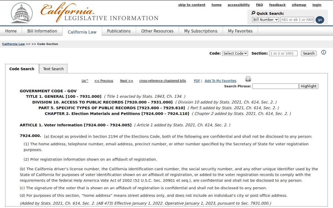
Home address, phone, email, precinct, and prior registration are confidential outside authorized access, while driver or ID numbers, Social Security or unique identifiers, and signatures remain protected. A ZIP field never cancels those limits.
Oakland ZIP Statistics Are Aggregate Clues
Alameda eData publishes interactive registration statistics and maps rather than a named voter list. Its counts are dynamic and should be dated when quoted. The official Alameda registration statistics map is useful for seeing how a ZIP or area is represented at an aggregate level.
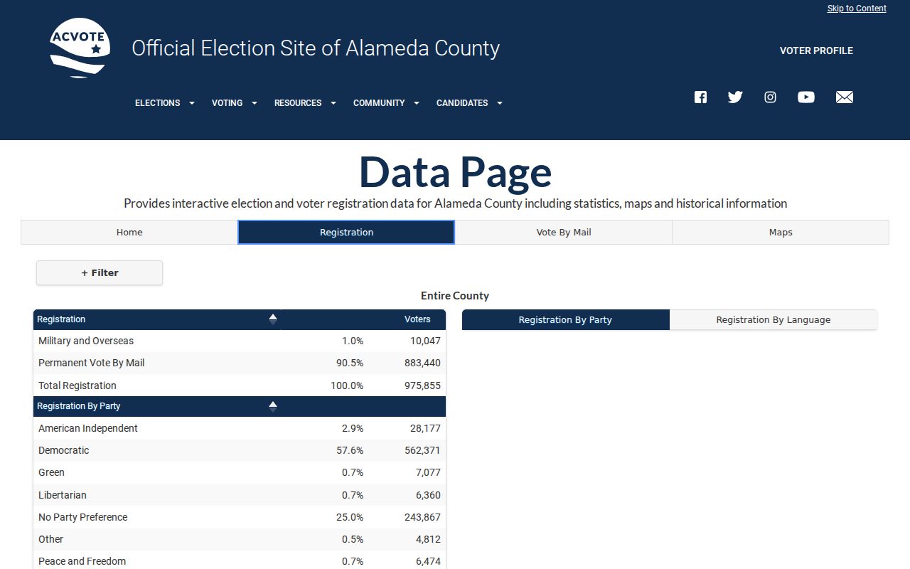
The map can add context to a ZIP discussion, but it cannot identify a household. A ZIP guide should label counts as aggregate, then send name or parcel questions to the proper custodian.
Oakland ZIP History Outlasts Postal Lines
Oakland grew through five annexations, and duplicate street names or later renaming can make an older address hard to place. A present ZIP may not match a directory, deed, or map label from an earlier era. The Oakland History Center's annexation map and Quentin's Guide to the Streets of Northern Alameda County help bridge changed names. Sanborn maps and tax assessor block books can then relate the old number to a parcel or building form.
Legal descriptions are stronger historical anchors than a postal label. Lot, block, subdivision, or metes-and-bounds language can survive a street rename, while an APN can change after subdivision, combination, or a boundary adjustment. Use the ZIP for orientation, the GIS layer for present geography, and the recorded or historical source for the identity that matters.
The CCPA also reminds readers that a commercial copy and a government record are different things. The Attorney General's privacy explanation describes access, deletion, correction, and opt-out rights for covered data.
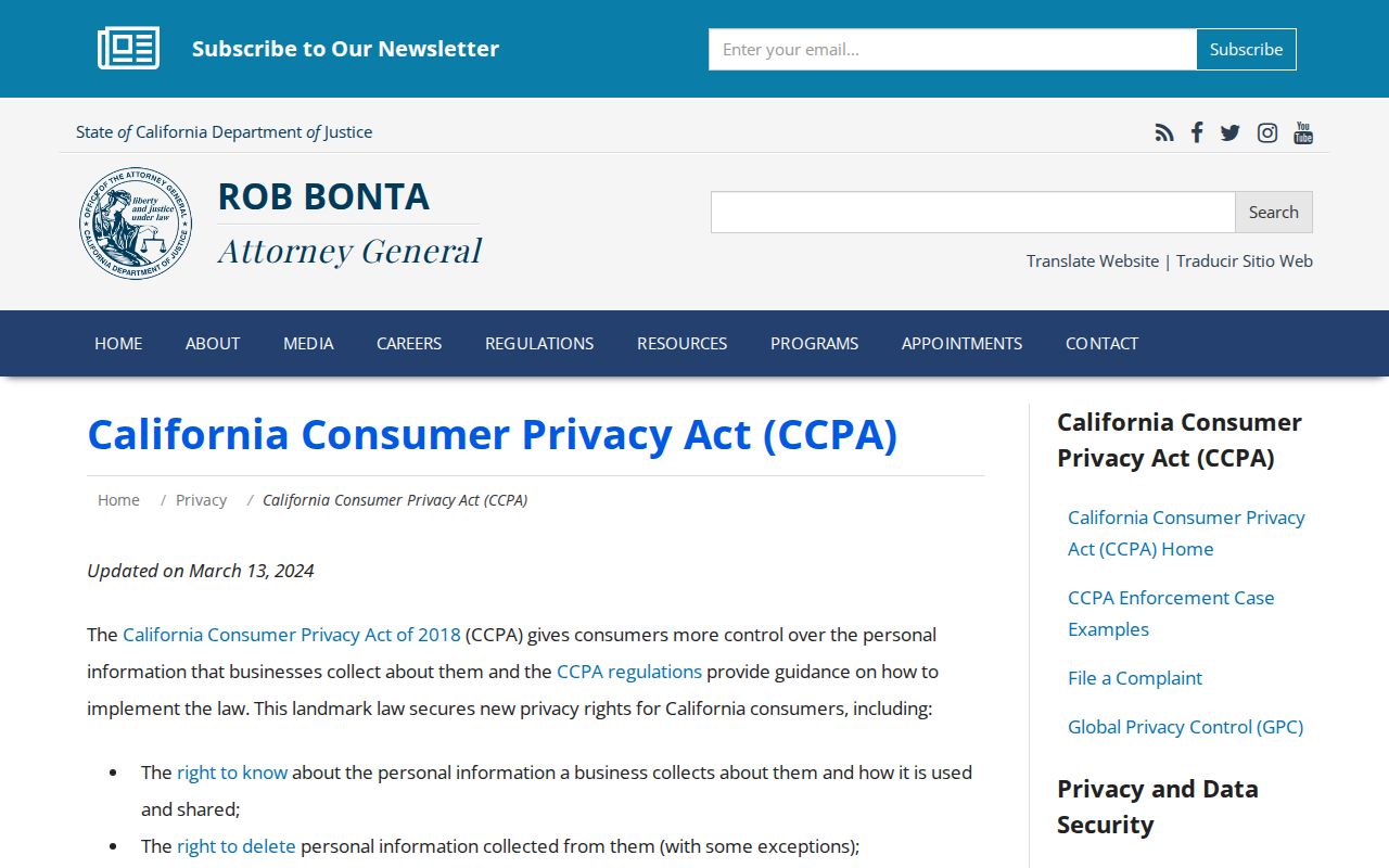
Deleting a commercial copy does not erase an official parcel, deed, or court record. The postal line, the city line, and the record custodian still need separate checks.